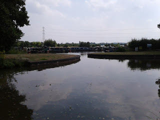
The canal was still descending after Weston and I got this shot of the paved way that horses had to make their way up and down. How did horses pass on the towpath? They are very narrow! Today we were lucky and there was little cycle traffic. Also after the first hour, when the path was sandy, it became largely grass covered and much better for the boots and the feet. Today we also found quite a few ripe blackberries on bushes beside the towpath.
I've not mentioned them before but there are a lot of Canada geese living in and around the canal. I think they may upset the farmers when large flocks land in their paddocks.
The next photographs deal with the towpath. The first shows a metal bridge which someone has erected over the gap which provides an entrance to a private mooring. Must annoy cyclists but at least it will slow them down. The second shows Shiel surrounded by her old enemy, Japanese Knot Weed. The canal is on her left, you just can't see it.
We passed the entrance to Great Haywood Marina at quarter to three and reached our B&B, High Meadows Guest House, at quarter past three. Only 17.4km but it took us 5 hours and 50 minutes! Tomorrow is predicted to be hotter, 27C. It doesn't sound a lot until you try walking in it carrying a pack.
Our Route
In July/August 2018 we walked from Liversedge in Yorkshire to Oxford, where possible, on canal towpaths.
The walk started on greenways in the Spen Valley until Ravensthorpe where we joined our first canal, the Calder and Hebble Navigation to Mirfield. In Mirfield we took a greenway to pick up the Huddersfield Broad Canal, after first getting slightly lost in the Colne Valley. We followed the Huddersfield Broad Canal into Huddersfield.
The next day we joined the Huddersfield Narrow Canal to the Standedge tunnel. As there is no footpath in the tunnel we walked over the Pennines, via the Wessenden Valley, to Diggle and the southern end of the tunnel. We followed the Huddersfield Narrow Canal to Ashton where we joined the Peak Forest Canal.
We followed the Peak Forest Canal to Marple where we turned off onto the Macclesfield Canal. We followed the Macclesfield Canal to Kidsgrove where we joined the Trent and Mersey Canal. Almost immediately we had to leave the Canal, as it entered the Harecastle Tunnel, and follow a modified version of the route taken by draught horses in the early days. We rejoined the towpath at the southern end of the tunnel.
We followed the Trent and Mersey Canal to Fradley where we joined the Coventry Canal which we followed to Fazeley Junction, where we joined the Birmingham and Fazeley Canal.
We should have left the Birmingham and Fazeley Canal where it passes under the M6 and joined the Birmingham and Warwick Junction Canal, as we were going through Warwick. However we missed the junction. Even so I thought we could go into central Birmingham and then head East towards Solihull and our accommodation.
We could have corrected our first mistake at Aston Top Lock and turned East on the Digbeth Branch Canal but missed our turn and headed into Birmingham. We almost reached the centre before we realized this second mistake. However from a canal and engineering aspect, the walk into central Birmingham was really interesting. It was a rewarding, if somewhat tiring mistake.
We walked back to the Aston Top Lock and followed the Digbeth branch for a short way to the Grand Union Canal, which was soon joined by the Birmingham and Warwick Canal, which we should have taken in the first place.
We followed the Grand Union Canal all the way to Napton Junction. At Napton Junction we turned south on our final canal, the Oxford Canal, which we followed to its end in Oxford.
We started on Monday, July 16 and finished on Monday, August 13. We walked 248 miles. We travelled for 29 days, with 5 rest days, thus averaging about 10 miles per day on our walking days.


No comments:
Post a Comment