Our Route


In July/August 2018 we walked from Liversedge in Yorkshire to Oxford, where possible, on canal towpaths.

The walk started on greenways in the Spen Valley until Ravensthorpe where we joined our first canal, the Calder and Hebble Navigation to Mirfield. In Mirfield we took a greenway to pick up the Huddersfield Broad Canal, after first getting slightly lost in the Colne Valley. We followed the Huddersfield Broad Canal into Huddersfield.

The next day we joined the Huddersfield Narrow Canal to the Standedge tunnel. As there is no footpath in the tunnel we walked over the Pennines, via the Wessenden Valley, to Diggle and the southern end of the tunnel. We followed the Huddersfield Narrow Canal to Ashton where we joined the Peak Forest Canal.

We followed the Peak Forest Canal to Marple where we turned off onto the Macclesfield Canal. We followed the Macclesfield Canal to Kidsgrove where we joined the Trent and Mersey Canal. Almost immediately we had to leave the Canal, as it entered the Harecastle Tunnel, and follow a modified version of the route taken by draught horses in the early days. We rejoined the towpath at the southern end of the tunnel.

We followed the Trent and Mersey Canal to Fradley where we joined the Coventry Canal which we followed to Fazeley Junction, where we joined the Birmingham and Fazeley Canal.

We should have left the Birmingham and Fazeley Canal where it passes under the M6 and joined the Birmingham and Warwick Junction Canal, as we were going through Warwick. However we missed the junction. Even so I thought we could go into central Birmingham and then head East towards Solihull and our accommodation.

We could have corrected our first mistake at Aston Top Lock and turned East on the Digbeth Branch Canal but missed our turn and headed into Birmingham. We almost reached the centre before we realized this second mistake. However from a canal and engineering aspect, the walk into central Birmingham was really interesting. It was a rewarding, if somewhat tiring mistake.

We walked back to the Aston Top Lock and followed the Digbeth branch for a short way to the Grand Union Canal, which was soon joined by the Birmingham and Warwick Canal, which we should have taken in the first place.

We followed the Grand Union Canal all the way to Napton Junction. At Napton Junction we turned south on our final canal, the Oxford Canal, which we followed to its end in Oxford.

We started on Monday, July 16 and finished on Monday, August 13. We walked 248 miles. We travelled for 29 days, with 5 rest days, thus averaging about 10 miles per day on our walking days.


Tuesday 31 July 2018

Aston Junction to Solihull.

The first photograph below is a view north to the bridge at Aston Junction that we should not have crossed. We came south from behind the bridge and should have turned to our left into the Digbeth branch canal, i.e. turned down the channel to the right in the photograph.
The path initially rural led through a smart, new office area

but within five minutes we were underground, in a quite long tunnel. At least it was illuminated.
We came out on the campus of Aston University with its beautiful location beside the locks before within a further few miutes descending into a tunnel again.


Shortly after emerging from the tunnel we had views towards central Birmingham and the 'Bull Ring' from Digbeth Junction where we branched left onto the Grand Union Canal.
Ten minutes along the Grand Union Canal and we were joined, from the north by the Canal we failed to find the start of this morning under the M6. The location seemed to be particularly popular with graffitti 'artists.'
As we left the city behind the canal was more and more tree lined but the atmosphere was spoilt by an enormous amount of litter along the banks of the river and floating in it, especially before bridge 67.

Approaching our turn off for the day, at Solihull, the surroundings and the canal condition started to improve somewhat. Surprisingly the B&B owners have a narrow boat on the canal and we should pass it as we head towards Hatton Station tomorrow.


Aston Junction towards Birmingham. Wrong Way!

To be completed if time permits.

Erdington to Aston Junction.

Shiel's travel agent (me) didn't plan today's walk with enough care. Ordinance Survey 1 in 50,000 maps are not sufficiently detailed for canal walks through Birmingham. Be warned! It helps to know what canal you're supposed to be following. As a result we went wrong, twice. The first one I was aware of, the second one I wasn't. As a result we finished walking 15 miles today. The good news is we saw some interesting bits of the Birmingham and Fazeley Canal entering Birmingham which we would have missed if we'd followed the correct route.

We got off early leaving the 'Rollason Wood Hotel' at 9:00am and it was all downhill to the canal which we reached in 20 minutes. It was cool, but sunny, and it had obviously rained quite heavily in the night judging by the size of puddles near the road.

The path initially gave no impression of being in a big city passing through green trees but that changed quickly as we went below an urban area in a massive concrete tunnel.


We passed beside the M6 and the traffic noise was quite unpleasant. It was under the M6 that we found the mostly, for you, illegible sign which I misunderstood and made the first mistake of the day.


I mistakenly thought we should keep on The Birmingham and Fazeley Canal, I was wrong. However I found out in about 15 minutes but carried on as it was an alternative route south and also marked on my map as a cycle/greenway.  It was very narrow to start with running through an aqueduct over the river Tame but soon widened again.
The surroundings were initially remarkably rural but soon became urban, and after about one hour on the canal, when we were passing a lock climbing into Bimingham, quite industrial.


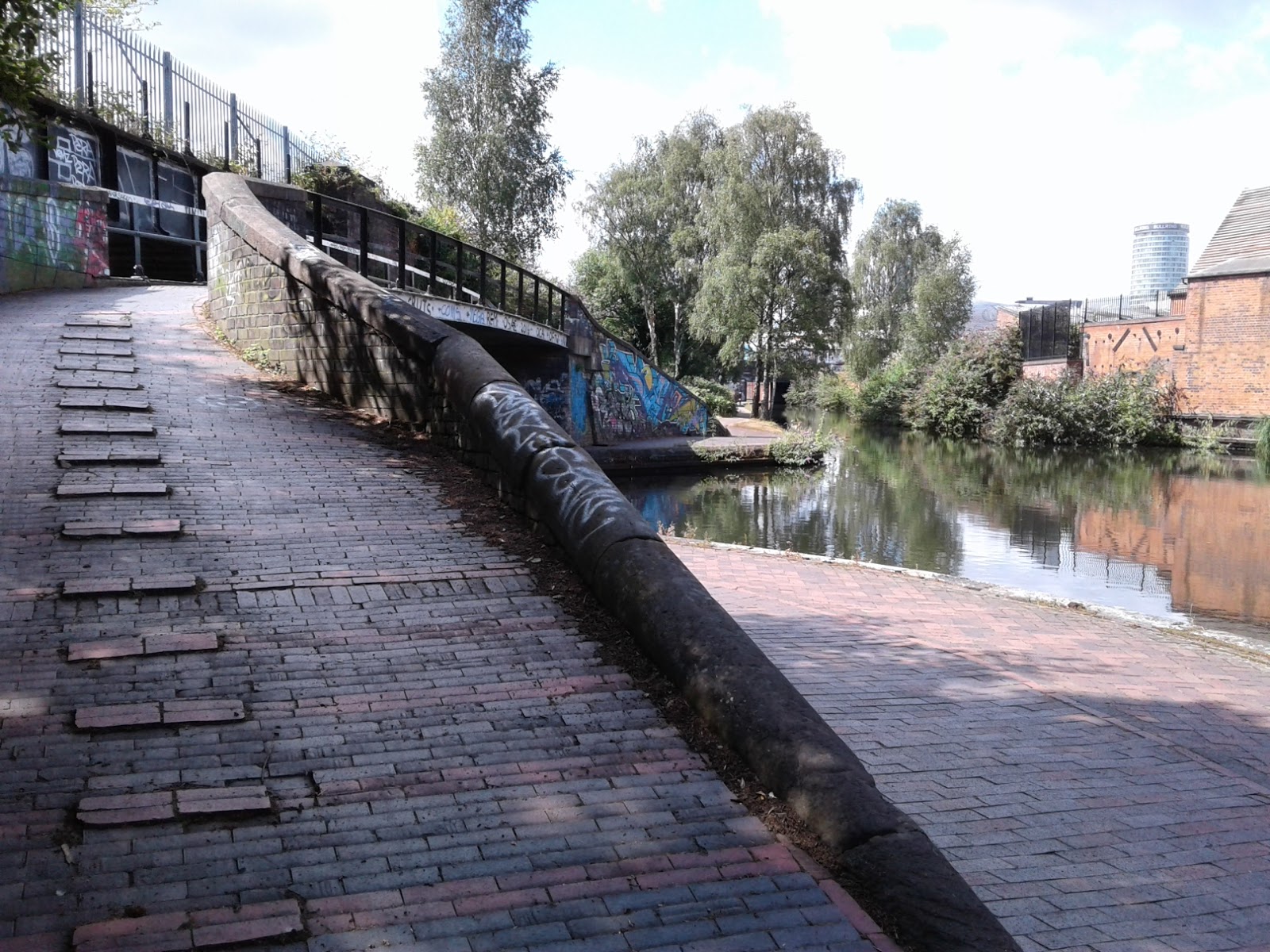
Twenty minutes and many lock later we arrived at the bridge shown below. It switched the towpath from the LHS to the RHS of the canal. We went across it. That was our mistake. We should have turned left down the Digbeth branch canal. We were at Aston Junction.

Monday 30 July 2018

Fazeley Junction to Erdington. 2

We passed about a dozen locks today but I've just shown a couple of them below. They all lifted the canal higher as we approached Bimingham


Remarkably the canal allows a nice green entry into Bimingham, a major city, but certain things were apparent today. road noise was intrusive. First it was from the M42 and later the M6. It is really quite unpleasant when you are not used to it. Britain appears to be overpopulated with both people and cars. I put the photo of the bridge in below to remind me of the problem.

We came across another long tunnel today, The Curdworth Tunnel, but at only 52 metres long neither Sheil nor I experienced 'the walking uphill effect.'


The wind was very calm today and we got some very clear reflections in the canal. Sadly I only noticed them when looking at the photographs.

After nearly 4 hours we reached 'The Boat Inn' and we were hoping to get soup. Sadly the sign is misleading. They do not serve meals Mondays and Tuesdays!!!!!!

As we progressed into the city housing increased but it was not unpleasant at first but as we came nearer and nearer to our turnoff in the city gaffitti and litter increased.


The last photograph is the penultmate bridge to our turn off in Erdington. Our Hotel was about 3/4 mile uphill from the canal. It was a pleasant but noisy day and not too long at 19.8km and 10 minutes short of six hours.


Fazeley Junction to Erdington. 1

Yesterday we had the day off in Fazeley and Tamworth to go to the laundrette and to visit Tamworth Castle. It rained! It's the first significant rain we've had in almost 6 weeks. It's good we were not walking.

We left the Fazeley Inn at 9:20am today and were at the start of the canal within 5 minutes. The  photograph below shows the first bridge on the Bimingham and Fazeley Canal south of Fazely Junction and the second shows the view through it. Initially there was a small amount of housing and a marina but the views soon became more rural.


We passed a barge (blue one in photo) which had been lifted out of the canal and was spported on blocks to allow its bottom to be scraped and painted. Apparently one needs to get this done every few years.


After 15 minutes we passed The Drayton Turret Bridge. It is one of the most ornate bridges on the  British Canal System we have been told. No room for horses and even a human finds it a bit of a squeeze on the stairs.


We made another discovery on the canal today. We passed anothrr bridge with a gate built in the side. The whole behind the gate was about 2 to 3 metres deep, but not the full width of the bridge. Shiel suggested it was used to store the boards used for blocking off bits of the canal, to allow sections to be drained to allow repairs. There were a few people today out working for The Canal and River Trust. I mentioned the bridge to him and he confimed Shiel's suggestion.

After about an hour's walking we came across our first lock today but it was the first of many, rising as we made our way south to Bimingham. After a couple of hours we stopped for liquid refreshment at the 'Dog and 'Doublet' situated beside the canal.


Saturday 28 July 2018

Huddlesford to Fazeley Junction.

An hour after lunch we passed this signpost beside the canal. It marks where The Bimingham and Fazeley Canal met the Coventry Canal in July 1790.


What part of the canal we are now on, up to Fazeley I'm not sure. I thought it was at Fazeley Junction we joined the Birmingham and Fazely Canal. Whilst there are no draught horses on th towpath thesedays I did see this group go by through a gap in the hedg.


On two occasions we passed bridges with little gates on the side. They were not present on the other side of the bridge though. Were they for storage.


As it was going to be a long day we stopped at the 'Tame Otter' for refreshment. The Tame is the name of the river running beside the canal today.


We arrived at Fazeley Junction seven hours after starting this morning and I estimate we covered about 14 miles by the time we reached The Fazeley Arms, our B&B. You can see two bridges in the photograph below. The one on the right leads to The Bimingham and Fazeley Canal and the one on the left leads to the Coventry Canal.


Rileyhill to Huddlesford.

We left our B&B at 9:30 am. It was about ten degrees below yesterday's peak with a good strong wind. Much better weather for walking in. The first photo shows a view down the towpath, it was largely rural all day. The second shows a view over the countryside. The farmers are busy cutting their wheat before the rain, forecast for later today.


Within the hour we were at Fradley Junction where we turned right (south) onto the Coventry Canal. The Trent and Mersey continued straight on. Sadly the Swan pub wasn't open when we passed.


Some times the towpath was clear an open, others it was overgrown.


There was quite a bit of activity on the canal and we met a few boats we'd seen before. It was particularly busy near marinas.


It was 3 hours before we passed a pub which was open, The Plough at Huddlesford, where we had soup for lunch. A lot of pubs don't open before 12 even in touristy areas.